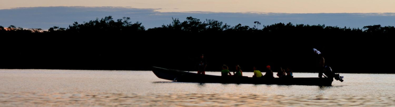
The invisible line made visible by Ecuador is photographed daily by people from all over the world. Something about putting one foot in each hemisphere makes people ecstatic, and let’s be honest — the equator is a nice thing to check off the bucket list. But the infamous line has also become a source of scrutiny: if there’s more than one, which one is accurate? We have a long answer for that, but we’re also here to show you why there’s much more to it than “crossing the line”.
BACKGROUND AND HISTORY
Ecuador is named after this imaginary line that divides the northern and southern hemispheres. And even though the equator passes through 13 other countries around the globe, no other country exhibits this much pride in its unique geographical location at “the middle of the world” or “mitad del mundo”. The reason is that Quito, Ecuador’s capital, is the major city closest to the equatorial line, which made it practical to develop a monument and huge following around it. Additionally, Ecuador’s altitude makes the country’s location even more unique: it is a place characterized by unusual weather patterns, an unrelenting sun, and the point on the globe farthest from the Earth’s core. But what exactly is the equator line, and what is so interesting about it?
The line is essentially the reference point from which latitude is measured (there, it is 0°), and lies perpendicular to the Earth’s axis. The distance from the equator line to each pole is exactly the same. And these geographical characteristics actually mean something beyond numbers scientific terms. The features of this particular spot on the planet can be summed up by the following two phenomena: 1) the equatorial bulge, and 2) a weaker gravitational pull. The equatorial bulge is the result of the Earth’s diameter being wider at the equator: due to rotation, the diameter is wider by approximately 42 kilometers than it is if measured between the poles. And as a result of the rotation that causes this bulge, gravitational pull is at the equator than at the poles.
This natural wonder is hardly a recent discovery. Yes, it is now exploited for tourism, and many foreign scientists have worked hard over the centuries to study this special point on the globe. But way before the cameras, the masses of tourists posing on the line, and the modern GPS equipment that put the line’s accuracy in flux, Ecuador’s cultures were well-aware of their positioning in the middle of the world. The pre-Columbian Quitu culture took its name from it: “qui” meaning middle, and “tu” meaning earth. They were using a sundial before the French mission came to study the line with surveying equipment in the 18th century. So before you quickly dismiss it as a tourist fad, keep in mind that the place’s particular attributes were studied and acted upon well before TripAdvisor!
THE “MITAD DEL MUNDO” MONUMENT – QUITO
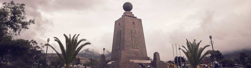
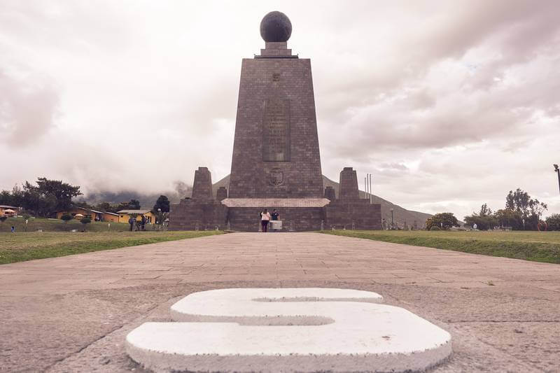
The “Middle of the World” monument was built in the late 20th century to commemorate the first Geodesic Mission of the French Academy of Sciences, which brought French scientists (and some Spanish naval officers) to determine the equatorial line in 1736. “Geodesic”, which originally meant the shortest line between two points on a curved surface, became generalized to define the science of measuring the Earth’s size and shape. This mission was significant in that it sought to enlighten the 18th-century scientific community’s debate around the Earth’s circumference, but also in that it was the first major international scientific expedition. Because the French Academy of Sciences was particularly eager to set the record straight, it sent two expeditions: one to Lapland at the North Pole, and the other to Ecuador. France enlisted the help of Spain because of its presence (by way of colonization) in South America.
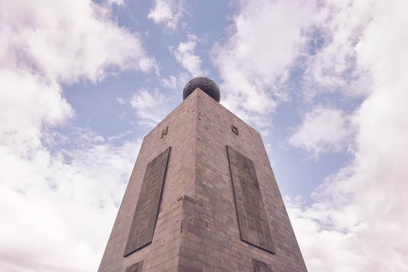
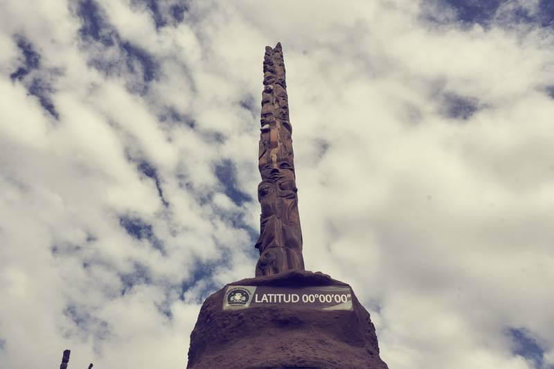
This monument was built to commemorate the mission, which was one of the first that employed modern scientific principles. Before the actual standing monument, an earlier one had been built in 1936 for the same purpose, but it was significantly smaller and off by a few hundred feet. Today’s monument is a 30-meter tower structure that holds up a giant globe. The monument is surrounded by a large, plaza-like open space, with the four cardinal directions imprinted on large stones. A bright yellow line runs down the middle, and you can be sure that someone is always standing on it, with one foot on each side.
The monument is impressive, or at the very least, grandiose in appearance. But it has been confirmed to be misplaced, approximately 240 meters from the actual equator line. How this happened, we will probably never know. Some say that the actual equator line’s location didn’t lend itself to the building of such a monument, and others simply accept that the French Mission’s measurements were outsmarted by modern GPS devices. However, everyone generally agrees that the line at this monument is a misplacement, almost two football fields south of the actual equator. This hasn’t yet affected the number of visitors it gets on a daily basis, though it has generated lots of confusion and scrutiny, even among tourists who are eager to capture that iconic photo.
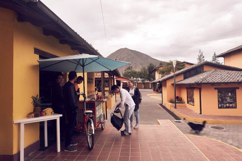
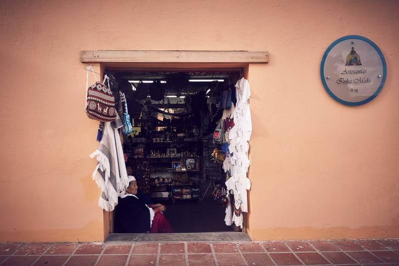
The immediate area around the monument is a small labyrinth of artesanal shops, cafés, restaurants, and other scientific establishments. There’s a planetarium, a craft beer museum, and a large plaza. So when you’re done stepping over the line, climbing the tower of the monument, and taking a photo next to the “Mitad del Mundo” sign, you can actually enjoy a pleasant afternoon walking around the area. Misplacement aside, if you go to the monument and take it for what it is — a monument honoring the scientific engagement sparked by the equatorial line, you’ll leave with more curiosity than disappointment!

THE INTINAN MUSEUM
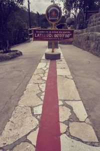
When GPS technology revealed the monument’s misplacement, a property a couple hundred meters away rejoiced: they were on the newly detected, “actual” equator line. It was quickly developed into the Intiñan Museum, which, aside from promoting their line’s accuracy, gives visitors an ethnographic history of Ecuador’s regions. The museum defends its claim to equatorial accuracy very successfully, and is now often referred to as the “real” line that people visit before or after taking a photo at the monument. Some even skip the monument altogether to instead do the 1-hour tour at Intiñan that is as fun as it is engaging. The following are the mini-exhibits you can enjoy at the museum (all are part of the guided tour):
- The Huaorani hut – This hut is representative of Ecuador’s Amazon and the people that continue to inhabit it, some uncontacted. The hut was actually built by a family from the Huaorani community, who came and lived at the museum for two weeks with the sole purpose of recreating their living space. The hut is a multifamily construction and has life-like representations of people, as well as illustrations of the Amazon’s extensive richness, and examples of appliances used by the Huaorani.
- The Amazon exhibit & shrunken heads – This exhibit displays some of the Amazon’s most abundant and iconic flora and fauna. The most interesting part of this exhibit are the shrunken heads, or Tsantas of Ecuador’s Jívaro tribes. Of these, the Shuar have historically been notorious for their wars, but more notorious for shrinking the heads of their enemies as battle trophies. The guide explains how they did this, and you can see some eerie examples!
- An original choza – This choza, or hut/home, is allegedly the representation of an actual residence that stood in the exact same spot in 1875. Made from mud, stone, excrement, and bamboo, it’s a testament to how effective these materials were at keeping traditional homes warm and anti-seismic. In one of the hut’s corners, a dozen guinea pigs are fenced in — word on the street is that if they keep quiet while you’re inside, you’ve given off a good vibe!
- The chocolate exhibit – This is a fairly new, but fun (and delicious!) addition to the museum. The exhibit maps Ecuador’s cacao-producing regions, displays a cacao tree, and allows you to taste some cacao pulp, nibs, and of course — the finished product.
- The shadow clock – Also referred to as the solar clock, this stone tool was used by ancient Ecuadorian cultures to tell time. However, there aren’t any numbers on it, and in lieu of two hands, a single rod protrudes from its center. The clock is divided into three sections: tuta manta, chisi, and pajta, meaning morning, afternoon, and midday. The way the sun casts a shadow on the rod is a very accurate way to tell time.
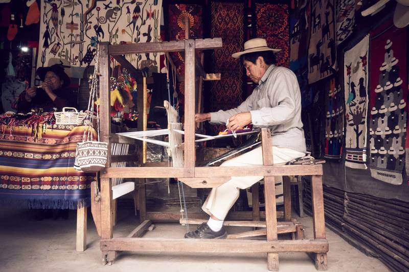
Aside from these small exhibits, Intiñan has a small artesanal shop which features the work of artisans from Salasaca, a town in the Tungurahua province between Ambato and Baños. Among their most valued crafts are hand-woven tapestries made on looms that use ancient technology. The artesanal shop faces an open space used for yet another fun feature: the diablo huma dance. The diablo huma, which means “devil’s head”, represents the resistance to Spanish imperialism and the Catholic imposition. It is a very popular figure in Ecuadorian tradition, and appears at almost every parade during national holidays, masked and colorful.
But the real fun to be had at Intiñan is at the equator line itself. While it is not as “monumental” as its misplaced counterpart, it does its job: marks the Mitad del Mundo accurately (latitude signage and all), and its bright red color will make it highly visible for that photo you’ll inevitably want to take.
Your guide will take you through a series of demonstrations that are a result of the Coriolis effect and the equator’s weaker gravitational pull, which are both a result of the Earth’s faster rotation at equator than at the poles. The Coriolis effect essentially comes down to the fact that the forces in each hemisphere are different, and objects follow a different deflection pattern depending on location: to the right in the Northern Hemisphere, and to the left in the Southern Hemisphere. This applies to fluids moving across large areas, which explains large-scale weather patterns. As for the weaker gravitational pull, the equatorial bulge makes it so that you’re further away from the Earth’s mass than anywhere else, so the planet exerts less pull on you. The following are the amusing demos you’ll see and be asked to engage in:
- Water spinning different ways: As a direct result of the Coriolis effect, the guide will drain water down a faucet, and you’ll see that its rotation is different depending on whether it is in the Northern or Southern hemisphere. When placed right on the line, it does not rotate, but goes straight through.
- Balancing the egg: The same force (or absence of it) that explains the water’s lack of deflection at the line supposedly makes it easier for you to balance an egg on a nail. Because the yolk will go straight down, the balancing act should be more feasible at the Middle of the World. This demo is especially fun, as there’s the incentive of receiving a certificate if you are successful!
- Walking the line: By the same logic that explains differential forces on each hemisphere, when you walk down the line with your eyes closed and arms out, you tend to go a bit off path. And most likely lose your balance. This demo is usually a source of laughter, and sometimes competitiveness, among the group!
- Arm pushes: The guide will instruct you to lock your hands, extend your arms and raise them, and hold the position as strongly as possible as they try to push them down. On either side of the hemisphere, the guide will struggle to get them to budge. But do the same thing exactly on the line, and the guide will succeed at pushing your arms down with significantly more ease. That gravitational pull did make a difference after all, didn’t it?
These demos have been highly criticized by those taking a microscopic look at their validity. There is controversy around their scientific basis, and they’re often dismissed as fads created for tourists. The main argument against them is that while the effects are real, the scale of the demos isn’t enough to produce a real phenomenon (whereas water in large volumes, for example, would). But they are not unfounded, and taken with a grain of salt they are incredibly fun and do illustrate the what the effects of the Earth’s forces look like on a small scale. Our suggestion is to go with the objective of enjoyment, and if you feel inclined to criticize the museum’s claims, save it — the guides are used to visitors who seem to rival Isaac Newton’s genius, and your scrutiny won’t go too far. So it’s best to check your skepticism at the door, walk the line, get that egg certificate, and hopefully close with a diablo huma dance after all of it!
THE QUITSATO SUNDIAL
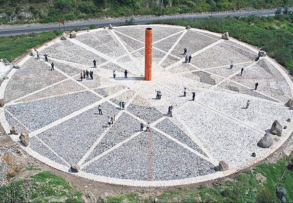
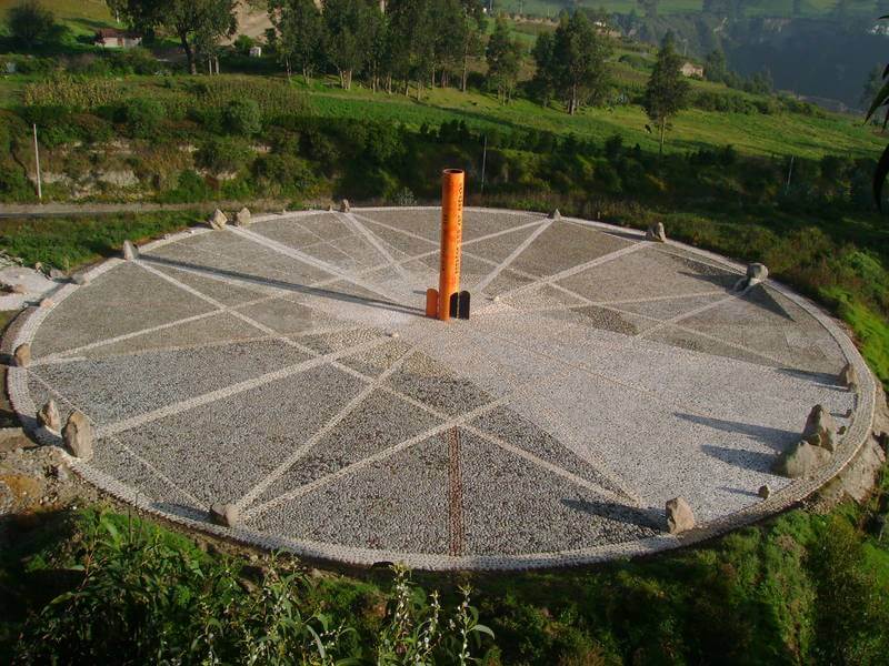
Wait, there’s a third? Yes, and to make matters even more confusing, even though it’s relatively at a distance from Intiñan, it’s considered the other “true” equator. But bear with us, as the confusion and mystery surrounding all of this is the point — after all, its complexity is far greater than we could ever begin to explain. One of the theories out there holds that the equator isn’t actually a “line”, per se, but rather a broad strip about 5 kilometers wide. This is likely the reason that measurements vary, and why you wouldn’t actually be able to stand with one foot on each hemisphere. The “broad strip” logic rather sees the equator as the point where Earth is roundest between North and South, and this spot is in Cayambe, 80 kilometers north of Quito.
This spot — the Quitsato sundial — is the least popular of all three, but it is equally interesting. Here, your phone’s GPS will reliably show a latitude of 0° 0’ 0’’. The sundial was developed in 2006 and is a 52-meter wide space with a 10-meter tall pole at the center, from where the sun casts a shadow that tells time. It is essentially a large-scale version of the stone solar clock you’ll see at Intiñan, except its location is much more intentional. There are lookout points on two sides of the sundial, from where you can appreciate the structure itself, and tell the time of day and month of the year. Quitsato offers guided visits (these are rather short) to help visitors better understand how the sundial works, challenging conventional ways of understanding geography and ultimately educating people about the sun’s relationship with our planet.
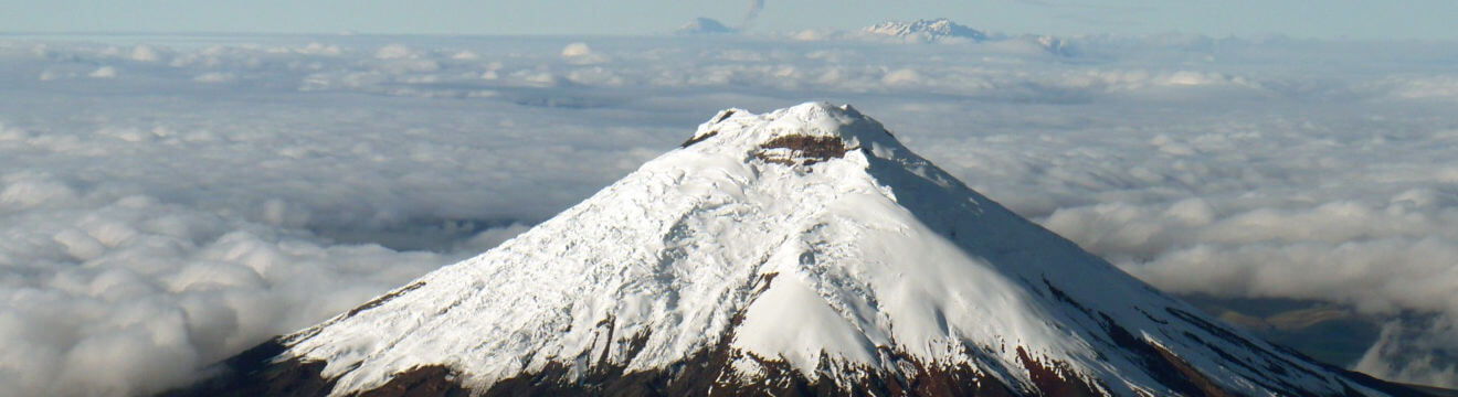
We highly recommend visiting this if you’re on a mission to learn everything you can about the equator. As a plus, you can stop by the delicious bizcocho shops on the way, and maybe even catch a view of the majestic Cayambe volcano.
OTHER FUN FACTS ABOUT MITAD DEL MUNDO
Hey, if you’ve gotten this far, consider yourself an equator expert! And you might want to visit all three locations, at that. We want to give you comprehensive information about places so you can avoid digging through the internet for bits of knowledge in different places. So, as a bonus, here are some other fun facts about Ecuador’s geographical position at the equator that you’ll find fascinating!
- Ecuador’s highest peak, Chimborazo volcano, is the point on Earth closest to the sun. The equatorial bulge pushes Chimborazo out further from the center of the Earth than Mount Everest.
- Places along the equator are the only spots in the world where you can see the stars in both hemispheres. On a clear night, you see both the southern cross and the big dipper at the same time.
- Sunrises and sunsets along the equator are very fast, and the length of days remains more constant throughout the year than in any other place.
- Because of weaker gravitational pull along the equator, an object at the equator weighs 0.5 percent less than at the poles.
PLANNING YOUR VISIT
Community Adventures Mitad del Mundo Tour:
- Our tour takes you first to the Intiñan Museum, where a guided group tour will show you all the features we mentioned previously. After Intiñan, our driver takes you to the actual monument for a 30 minute self-guided tour (everyone can use this time as they please, and then meet the van at a predetermined location and time). The Intiñan Museum and the monument are a short, 5 minute drive away from each other.
- The drive to Mitad del Mundo is about a 45 minute drive, and the duration of both visits is approximately 2 hours total. You should be back in Quito (at Community Adventures) around 6 p.m.
- Cost: $10 per person
- Days and times: Monday through Saturday at 2:30 pm
Book our Mitad del Mundo Tour.
Visiting the Quitsato sundial:
The Quitsato sundial is about an hour drive from Quito and will normally require you to arrange transportation on your own. However, our Otavalo tour makes a short stop here on the way to the market and that is a great alternative if you want to squeeze this into another great tour!