Quick answer: You can hike the Quilotoa Loop without a guide in 3 days: bus from Quito’s Quitumbe terminal to Latacunga (about 2 hours), then to Sigchos, and walk Sigchos → Isinliví → Chugchilán → Quilotoa, roughly 35–40 km in total. Stay in village hostels that include dinner and breakfast, start each stage by 8–9 a.m. and finish before dark.
We are local guides based in Quito, and the Quilotoa Loop is the trek our hostel guests ask about most after Cotopaxi. Plenty of them walk it on their own and love it, so this guide is the honest DIY version: the buses, where to leave your big bag, what each day really feels like, and the spots where people get lost. If after reading it you decide you would rather skip the logistics, we will also tell you which of our tours covers the same ground.
What is the Quilotoa Loop?
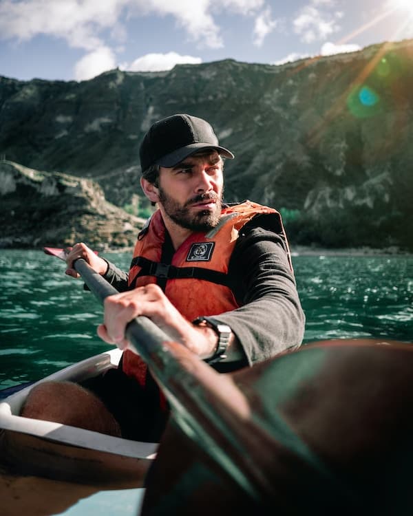
The Quilotoa Loop is a network of village-to-village trails and rural roads in Cotopaxi Province, about 3–4 hours south of Quito. The hiking version most people do links four Andean villages, Sigchos, Isinliví, Chugchilán and Quilotoa, and finishes on the rim of the Quilotoa crater lake at around 3,900 m.
It is not a wilderness trek. You walk past farms, cross the Toachi river canyon, share paths with sheep and kids walking home from school, and sleep in a real bed every night. That is exactly its charm: you get three days inside rural highland life, not just a viewpoint.
How many days do you need for the Quilotoa Loop?
Three hiking days is the classic plan, with two nights on the trail (Isinliví and Chugchilán) and a third night at Quilotoa if you want sunrise over the lake. Add a half day at each end for buses, so budget 4 days door to door from Quito.
- 3 days / 2 nights: Sigchos → Isinliví → Chugchilán → Quilotoa, then bus back to Latacunga the same afternoon. Doable, but a long last day.
- 4 days / 3 nights: same route, sleep at Quilotoa and catch a morning bus. Our recommendation for most people.
- 2 days: skip Sigchos and start in Isinliví, or walk only Chugchilán → Quilotoa if you are short on time.
How do you get from Quito to Latacunga and Sigchos?
Quito to Latacunga
Buses south leave from Terminal Quitumbe, Quito’s southern bus station. From the Old Town it takes around 45 minutes by taxi or public transport, so leave early. Several cooperatives run the route and a bus leaves every 30–60 minutes from early morning. As of 2026 expect about $3–4 and around 2 hours, depending on traffic leaving Quito (current fares by cooperative). Many buses heading to Ambato or Baños also stop in Latacunga; just confirm with the ticket office.
Leaving your big bag in Latacunga
Do not carry a 20 kg backpack up to Quilotoa. Several hostels in central Latacunga store luggage for loop hikers, for example Hostal Café Tiana, which has charged around $1 per bag per day. Ask before you book, pack a small daypack (25–35 L is plenty) and collect the big bag when you come back through Latacunga.
Latacunga to Sigchos
Buses to Sigchos leave from Latacunga’s main bus terminal, with several morning departures (the first usually around 6 a.m.). The ride takes about 2 hours and costs roughly $2.50–3.50. Times change often and service is reduced on some days, so check the posted schedule at the terminal the day before. If you want to skip Sigchos and start in Chugchilán, the Black Sheep Inn transport page lists the direct Latacunga–Chugchilán buses (about 2.5–3 hours).
Local tip: If you reach Latacunga after about 11 a.m., do not try to get to Sigchos and hike the same day. Sleep in Latacunga, store your bag, and take the first Sigchos bus in the morning. Starting the Isinliví stage at 2 p.m. is how people end up on the canyon trail at dusk.

Which direction should you hike the Quilotoa Loop?
Hike from Sigchos toward Quilotoa. Almost everyone does, and for good reasons:
- You finish at the most impressive spot, the crater rim, instead of starting there.
- You acclimatize gradually, from about 2,800 m in Sigchos to 3,900 m at the rim.
- Most online tracks, trail notes and signposts are written for this direction.
The reverse direction (Quilotoa → Chugchilán) is mostly downhill on the first day, which some people with knee problems prefer, but you lose the finale and it is easier to take a wrong line off the rim. If you want to walk only one stage, Quilotoa → Chugchilán is a reasonable choice.
Quilotoa Loop stages: distance, time and elevation
Distances vary by a couple of kilometers depending on the track you follow and small detours, so treat these as realistic ranges from recent GPS tracks as of 2026, not exact figures.
| Stage | Distance | Walking time | Elevation gain | Difficulty |
|---|---|---|---|---|
| Sigchos (≈2,800 m) → Isinliví (≈2,950 m) | 10–14 km | 3.5–5 h | ≈450 m | Easy to moderate |
| Isinliví → Chugchilán (≈3,200 m) | 11–12.5 km | 4.5–6 h | ≈800 m | Moderate, two steep climbs |
| Chugchilán → Quilotoa rim (≈3,900 m) | 11–13 km | 5–7 h | ≈950–1,000 m | Hard, long final climb at altitude |
| Total | 35–40 km | 3 days | ≈2,200 m | Moderate overall |
Day 1: Sigchos to Isinliví
The easiest day. You leave Sigchos on a dirt road, drop down into the Toachi river valley and follow the river before climbing up to Isinliví. Much of it is on country roads or wide paths, and the way is fairly obvious. The last climb into the village is steady, not brutal. Leave Sigchos by 9 a.m. and you will arrive in time for a shower and a nap.
Day 2: Isinliví to Chugchilán
Our favorite stage. You cross to the other side of the canyon, pass the small community of Guayama San Pedro, go down to the river again and then face a steep climb up to Chugchilán. There are more junctions today and more chances to follow a cow path by mistake, so keep your offline map open at every fork. Carry enough water for the whole day, because shops are rare between villages.
Day 3: Chugchilán to Quilotoa
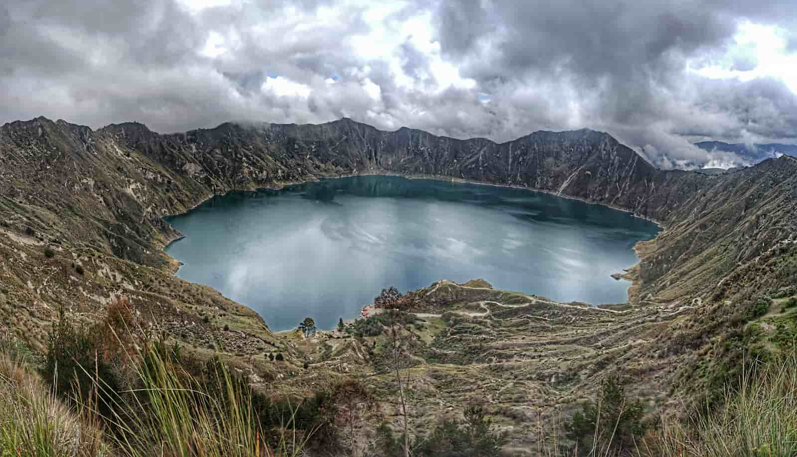
The hardest and most rewarding day. You drop into another ravine, then climb almost 1,000 m, ending with a long sandy switchback up to the crater rim. The last hour is above 3,500 m, where everyone slows down. From the top you walk part of the crater edge to Quilotoa village. Start early: afternoon clouds and wind roll in on the rim, and the views are best before noon.
Local tip: The final climb to the rim has a couple of loose, sandy sections. Trekking poles make a real difference there, and they are also handy for keeping farm dogs at a distance. You can buy cheap poles in Quito or Latacunga before you go.
How do you navigate the Quilotoa Loop without a guide?
You do not need a guide if you are comfortable with map apps and basic hiking. The route has painted markers and some signposts, but they fade, get moved or are missing at key junctions, so do not rely on them alone.
- Download offline maps before you leave Latacunga. Maps.me and Organic Maps show most of the trail, and Wikiloc or AllTrails have recorded tracks you can follow by GPS.
- Ask your hostel for route notes. Several lodges in Isinliví and Chugchilán give guests written directions for the next stage, and they are often more accurate than the apps.
- Ask locals. “¿Por aquí a Chugchilán?” goes a long way. People are used to hikers and usually point you the right way.
- Mobile signal is patchy in the canyons. Do not count on loading a map on the go.
Where to stay on the Quilotoa Loop
Every village has simple guesthouses, and most hiker lodges sell a half-board deal: bed plus dinner and breakfast, usually around $25–45 per person in a dorm or shared room as of 2026, more for private rooms. There are few places to eat in the villages at night, so the included dinner is not just convenient, it is often the only option. Book the first nights ahead in high season (July, August and the December holidays).
Isinliví
Llullu Llama Mountain Lodge is the best-known hiker lodge on the whole loop, a restored farmhouse with a hot tub, shared dinners and trail notes for the next day. It was still getting strong guest reviews in 2026. Hostal Taita Cristóbal is a simpler alternative in the same village.
Chugchilán
The Black Sheep Inn, a long-running eco-lodge just outside the village, quotes rates with vegetarian breakfast, packed lunch and dinner included. For a budget stay, Hostal Cloud Forest in the village center is a long-time backpacker favorite with cheap half-board dorms. Hostal El Vaquero is another option.
Quilotoa
Quilotoa village sits right on the rim and has many small hostels run by local families, such as Hostal Chukirawa. Nights here are cold, often near freezing, so check that your room has a wood stove or extra blankets.
How do you get back from Quilotoa?
Direct buses from Quilotoa to Latacunga are limited and run mostly in the morning (about 1.5–2 hours, roughly $2.50–3.50). If you miss them, take a shared pickup or taxi to Zumbahua, about 14 km away, where buses on the Latacunga road pass regularly (see Wikivoyage’s Quilotoa page for recent departure times). From Latacunga you can collect your bag and catch a bus to Quito, or continue south to Baños.
At the entrance to Quilotoa village the local community sometimes charges visitors a small fee, usually a couple of dollars, so keep small bills. Carry enough cash for the whole loop too, since there are no reliable ATMs after Latacunga.
Is the Quilotoa Loop safe to hike alone?
The Quilotoa Loop is generally safe and the villages are friendly. The real risks are practical ones:
- Dogs. Farm dogs bark and sometimes run at hikers. Stay calm, do not run, and bend down as if picking up a stone, which usually stops them. A trekking pole helps.
- Getting lost late in the day. Never start a stage after about 11 a.m. and never hike after dark. Sunset is around 6:15 p.m. all year and it gets dark fast.
- Weather. Afternoon rain and fog are common, and canyon trails turn slippery. Wind on the crater rim is strong and cold.
- Going solo. Plenty of people walk it alone, but tell your hostel which stage you are walking and when you left. Pairing up with other hikers from your lodge is easy.
For our wider take on safety in the country, see is Ecuador safe to travel in 2026.
How does altitude affect the Quilotoa Loop?
You sleep between roughly 2,900 and 3,900 m, and the final climb takes you to the highest point of the trek. If you arrive straight from sea level, spend at least two nights in Quito (2,850 m) before starting. Drink plenty of water, go easy on alcohol the first nights, and slow down on the climbs. Our guide to altitude sickness in Quito covers symptoms and what to do if you feel bad on the trail.
What should you pack for the Quilotoa Loop?
- Daypack of 25–35 L with a rain cover
- Broken-in hiking shoes with good grip for mud and loose sand
- Rain jacket, warm fleece or down layer, hat and gloves for Quilotoa nights
- Sunscreen, sunglasses and a sun hat: the Andean sun burns fast even when it is cold
- 2 liters of water capacity, snacks, and a water filter or purification tablets
- Offline maps, a power bank and a headlamp
- Cash in small bills for lodges, buses and snacks
- Trekking poles (optional, but useful on descents and with dogs)
For the full list by region, see our Ecuador packing list.
When is the best time to hike the Quilotoa Loop?
The driest months are June to September, with the clearest mornings and firmer trails, though July and August are also the windiest and busiest. December to February can be good too, with more afternoon showers. March to May is usually the wettest period, when canyon trails get muddy. You can hike year round; in the rainy season just start earlier and expect clouds by early afternoon.
Should you do the Quilotoa Loop on a tour instead?
Honestly, if you have three or four free days and like figuring things out, do it independently. It is cheap, the villages are welcoming, and the planning is part of the experience. It is the same spirit as our guide on how to travel to Cotopaxi independently.
A tour makes more sense if you only have one day, if you do not want to deal with buses, luggage and map apps, or if you want to see Quilotoa and Cotopaxi on the same trip.
Quilotoa Crater Lake · from USD 68 pp · 1 day · Tue, Thu, Sun
Transport from Quito, a bilingual local guide and lunch, with time to walk down to the lake. Kayak (about $5) and a mule ride back up (about $10) are optional extras.
Cotopaxi & Quilotoa 2 Day Adventure · from USD 170 pp · 2 days / 1 night · Wed–Thu, Thu–Fri, Sat–Sun
Bike and hike at Cotopaxi, a night at a lodge on the Avenue of the Volcanoes, then Quilotoa the next day, with guide, transport from Quito and most meals included.
If you are still deciding how Quilotoa fits in your trip, our Cotopaxi and Quilotoa guide compares the options, and our Ecuador itinerary shows where the loop fits in 7, 10 or 14 days. Want more trails? Check our roundup of hiking in Ecuador, or pair the loop with Baños and the waterfalls of Ecuador.
Local tip: Heading to Baños afterwards? You do not need to go back to Quito. From Latacunga, buses toward Ambato leave constantly, and from Ambato it is a short ride to Baños. It saves you half a day.
Plan it with us
Stop by our office at Community Hostel, Pedro Fermín Cevallos N6-78 y Olmedo in Quito, before you go. Our guides are happy to check current bus times, help you plan the stages or book the Quilotoa tour if you would rather keep it simple. You can also message us on WhatsApp at +593 97 953 3832 or email info@communitytravel.ec.
Frequently asked questions
Can you hike the Quilotoa Loop without a guide?
Yes. Most hikers walk the Quilotoa Loop independently. The route links villages with hostels every night, and trail markers, offline maps (Maps.me, Organic Maps, Wikiloc) and hostel route notes are enough for anyone with basic hiking experience. The main rules are to start each stage early, never hike after dark and keep your offline map open at every junction.
How long is the Quilotoa Loop hike?
The classic Sigchos to Quilotoa route is roughly 35–40 km with about 2,200 m of total elevation gain, split into three stages of 10–14 km. Most people take 3 hiking days and 2–3 nights, plus half a day at each end for buses from Quito and Latacunga. Fit hikers can compress it, but the altitude makes long days tiring.
How much does the Quilotoa Loop cost?
As of 2026, budget around $35–55 per person per day for the independent loop. Half-board hostels (bed, dinner and breakfast) cost about $25–45 per person in shared rooms, buses are about $3–4 from Quito to Latacunga and $2.50–3.50 for each local leg, plus snacks and bag storage in Latacunga. Carry cash, since there are no reliable ATMs on the trail.
Which direction is best for the Quilotoa Loop?
Start in Sigchos and finish at Quilotoa. This direction lets you acclimatize gradually from about 2,800 m to 3,900 m, most trail notes and GPS tracks are written for it, and you end at the crater lake instead of starting there. The reverse is mostly downhill on the first day, which some people prefer for their knees.
Is the Quilotoa Loop hard?
It is moderate overall. The first day from Sigchos to Isinliví is fairly easy, the second has two steep climbs, and the last stage from Chugchilán gains nearly 1,000 m to the crater rim at around 3,900 m. You do not need technical skills, but you should be comfortable walking 5–7 hours at altitude on uneven, sometimes muddy trails.
Where do you leave your luggage for the Quilotoa Loop?
Most hikers leave their big bag at a hostel in Latacunga, the transport hub for the loop. Several hostels store bags for a small fee, often around $1 per bag per day, usually for guests who spent a night there. Pack a 25–35 L daypack with layers, rain gear, water and snacks, and collect your luggage on the way back through Latacunga.
When is the best time to hike the Quilotoa Loop?
June to September is the driest period, with the clearest mornings and firmest trails, though it is also windy and busier. December to February is another good window. March to May tends to be the wettest, with muddy canyon sections. The loop is hikeable all year if you start early and expect afternoon clouds or rain.